At XRain, we believe that satellite precipitation data can provide valuable insight into the hydrology of many parts of the world that do not have rain gauges, or where this data is difficult to access. We believe that democratization of data will help people make better decisions, from planning appropriate crops to designing better infrastructure. We have a particular focus on providing extreme precipitation statistics for flood modeling (in fact, the “X” in XRain stands for “extreme”).
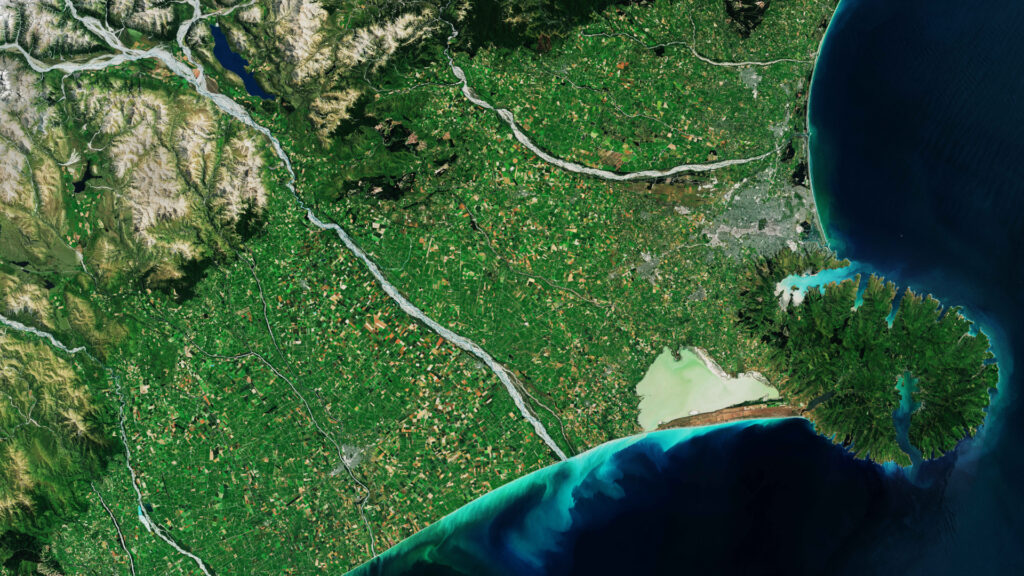
XRain is based in Christchurch, nestled in the Canterbury Plains of New Zealand’s South Island. Through the middle of the island run the Southern Alps, a range of mountains that collect enormous amounts of rain from the west, leaving comparatively little rainfall for Canterbury and other eastern parts of the island.
Canterbury is punctuated by numerous braided rivers (highly dynamic channels across wide gravel riverbeds) that bring water and sediment from Southern Alps, such as the Waimakariri (Māori for “cold water”) running along the northern fringe of Christchurch.
Founding director Dr Cameron Oliver is a hydrological and hydraulic engineer who has over nine years of experience in hydrological and hydraulic modelling for a variety of clients across New Zealand, Australia, Papua New Guinea and the Pacific Islands, including public sector, food and beverage, irrigation, and mining. He has been involved in flood modelling, flood risk assessments, water balance modelling and erosion protection design. Cameron’s PhD examined the mixing of brine from desalination plants and involved using software to extract trends from large datasets.
Got a question? Don’t hesitate to contact us.